GEOLOGICAL, AGRICULTURAL AND BIOLOGICAL DIVERSITY OF ARMENIA
 The
Republic of Armenia is situated in the southern part of the Caucasus between
watersheds of middle streams of the Araks and Kura Rivers. The territory
of the Republic is 29,800 sq. kilometres. It occupies the southern part
of a vast highland area known as Armenian Upland, which is located within
the Alpine-Himalayan mountain system. The average elevation of the Armenian
Upland is 1,800 meters above sea level. Ancient geographers called the
Armenian Upland the "Mountain Island" or the "Roof of Asia
Minor". In the structure of mountain ridges extinct volcanoes play
an essential role. Their activity left its mark on Armenian nature. In
the Armenian Upland eruptions of volcanoes have occurred relatively recently,
before eyewitnesses. The last eruption of the Nemrud volcano on the eastern
shore of Lake Van (Eastern Anatolia) was in 1441. Biblical Mount Ararat
dominates the Armenian Upland. It is isolated from the ridges and plateaus
and rises above the surrounding plains for more than 4 kilometres. The
massif consists of two extinct volcanoes - Greater Ararat (Masis), having
a height of 5,165 meters, and Little (lesser) Ararat (Sis), at 3925 meters. Their
peaks are located at a distance of 10 kilometres from each other. Ararat
is amazingly beautiful. It has attracted travellers since ancient times.
The most wonderful view of Mount Ararat is from the northern vicinity
of Yerevan - the capital of the Republic of Armenia. The Armenian landscape
is very picturesque and rich in numerous cultural monuments, such as rock
drawings, cave towns, excavations of ancient cities and Palaeolithic settlements,
remnants of the most ancient observatories and metallurgical centres,
creations of old and Medieval Armenian masters (temples, cloisters and
fortresses) and modern architectural ensembles. Usually tourists enjoying
the beauty of Armenian Nature are astonished by the results of its "creative
work" (pictorial landforms, rock sculptures, waterfalls, etc.) and
are interested in knowing the causes of their formation. Armenia is one
of those rare countries that, though small in territory,
The
Republic of Armenia is situated in the southern part of the Caucasus between
watersheds of middle streams of the Araks and Kura Rivers. The territory
of the Republic is 29,800 sq. kilometres. It occupies the southern part
of a vast highland area known as Armenian Upland, which is located within
the Alpine-Himalayan mountain system. The average elevation of the Armenian
Upland is 1,800 meters above sea level. Ancient geographers called the
Armenian Upland the "Mountain Island" or the "Roof of Asia
Minor". In the structure of mountain ridges extinct volcanoes play
an essential role. Their activity left its mark on Armenian nature. In
the Armenian Upland eruptions of volcanoes have occurred relatively recently,
before eyewitnesses. The last eruption of the Nemrud volcano on the eastern
shore of Lake Van (Eastern Anatolia) was in 1441. Biblical Mount Ararat
dominates the Armenian Upland. It is isolated from the ridges and plateaus
and rises above the surrounding plains for more than 4 kilometres. The
massif consists of two extinct volcanoes - Greater Ararat (Masis), having
a height of 5,165 meters, and Little (lesser) Ararat (Sis), at 3925 meters. Their
peaks are located at a distance of 10 kilometres from each other. Ararat
is amazingly beautiful. It has attracted travellers since ancient times.
The most wonderful view of Mount Ararat is from the northern vicinity
of Yerevan - the capital of the Republic of Armenia. The Armenian landscape
is very picturesque and rich in numerous cultural monuments, such as rock
drawings, cave towns, excavations of ancient cities and Palaeolithic settlements,
remnants of the most ancient observatories and metallurgical centres,
creations of old and Medieval Armenian masters (temples, cloisters and
fortresses) and modern architectural ensembles. Usually tourists enjoying
the beauty of Armenian Nature are astonished by the results of its "creative
work" (pictorial landforms, rock sculptures, waterfalls, etc.) and
are interested in knowing the causes of their formation. Armenia is one
of those rare countries that, though small in territory,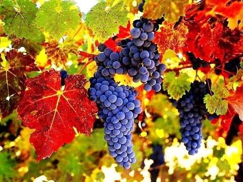 is notable for its complexity and rich diversity of its geological structures.
In a small area one can observe various signs of active geological processes
ever taking place on the earth and continuing today. These include strongly
transformed metamorphic rocks of the Pre-Cambrian basement and nearly
"fresh" lava flows of recent volcanoes; thick layers sedimentary,
volcanic-sedimentary and volcanogenic deposits of sea, deep- sea-
rift, lacustrine - continental basins, and products of magmatic activity,
including volcanic activity from the Middle Paleozoic up to the Quaternary
Age; the results of the complicated tectonic processes that took place
in the remote geological past, and signs of the contemporary tectonics.
To the above series one can add numerous ore and non-ferrous deposits,
sweet, thermal and mineral springs, as well as rare mineral associations
and interesting results of contemporary abrasion and erosion processes.
Among all this diverse Armenian geology are objects that could be assigned
to the rank of rarity, and often, unique natural geological monuments
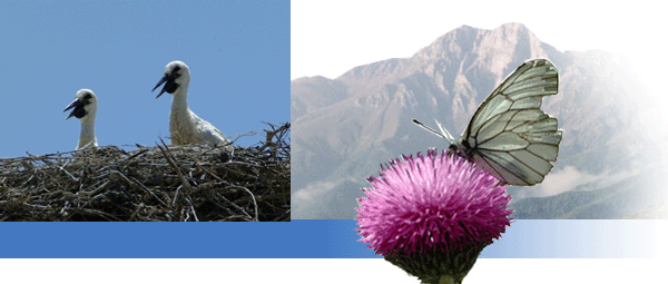
are to be found. The agri- biological diversity of wild relatives of cultivated
plants, medicinal, edible, wood, colouring, aromatic, fodder and many
other plants including many endemic, relict and rare species is surprising.
This is due to a number of factors such as:
is notable for its complexity and rich diversity of its geological structures.
In a small area one can observe various signs of active geological processes
ever taking place on the earth and continuing today. These include strongly
transformed metamorphic rocks of the Pre-Cambrian basement and nearly
"fresh" lava flows of recent volcanoes; thick layers sedimentary,
volcanic-sedimentary and volcanogenic deposits of sea, deep- sea-
rift, lacustrine - continental basins, and products of magmatic activity,
including volcanic activity from the Middle Paleozoic up to the Quaternary
Age; the results of the complicated tectonic processes that took place
in the remote geological past, and signs of the contemporary tectonics.
To the above series one can add numerous ore and non-ferrous deposits,
sweet, thermal and mineral springs, as well as rare mineral associations
and interesting results of contemporary abrasion and erosion processes.
Among all this diverse Armenian geology are objects that could be assigned
to the rank of rarity, and often, unique natural geological monuments
are to be found. The agri- biological diversity of wild relatives of cultivated
plants, medicinal, edible, wood, colouring, aromatic, fodder and many
other plants including many endemic, relict and rare species is surprising.
This is due to a number of factors such as:
- The country is located at the junction of major bio- geographic zones;
- Armenia provides an important passage and resting sites for migratory animals and birds;
- Seven main landscape types are represented across the different altitudinal zones of Armenia within a relatively small territory;
- Armenia has long been a center for breeding and selection of cultivated plants and livestock thus became an important endemic center for wild relatives of domestic crops.
Agricultural
species are of particular importance - Armenia is considered one of the
most important centres for agro - diversity since it represents a relatively
large area supporting wild relatives of crops and agricultural varieties.
The people of Armenia have used these natural resources for more than
5000 years, and have built important relationships between human society
and agribioversity, both through breeding and through use of agricultural
lands. Indeed, natural pastures and meadows represent a crucial natural
resource for Armenia, occupying a third of the country's territory. The
mountainous nature of Armenia results in a series of highly diverse landscape,
with variations in geological substrate, terrain, climate, soils and water
resources. These landscapes support a great variety of habitats, which
support distinctive flora and different human use. Seven distinct altitude
landscape zones have been 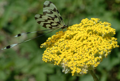 described
in Armenia: Deserts, Semi-deserts, Dry steppes, Steppes, Woodlands,
Sub-alpine, Alpine lands In percentage the first two cover 16%, mountain
steppes 37%, forest, thin forest, shrubs 20% and alpine and sub-alpine
meadows 28%. The total of species and endemic forms, from different taxonomic
groups that are represented in Armenia is about 17,500 of which 339 are
endemic
species or sub species. The number of wild relatives of crop plants found
in Armenia is 22 species and 218 sub species. Armenia is an ancient center
for the breeding of livestock and also supports the wild relatives of
domestic breeds. Endemic breeds of sheep were recognized as early as 9th
century BC, which have been selected from their wild ancestors, the Armenian
mouflon. Today mouflon are found in the south of the country. One can
also find here sheep, endemic races of goats and horses, which also originated
from the Armenian Plateau. Armenia became famous for its genetic variety
of cows, sheep, pigs, hens and rabbits over the past years.
described
in Armenia: Deserts, Semi-deserts, Dry steppes, Steppes, Woodlands,
Sub-alpine, Alpine lands In percentage the first two cover 16%, mountain
steppes 37%, forest, thin forest, shrubs 20% and alpine and sub-alpine
meadows 28%. The total of species and endemic forms, from different taxonomic
groups that are represented in Armenia is about 17,500 of which 339 are
endemic
species or sub species. The number of wild relatives of crop plants found
in Armenia is 22 species and 218 sub species. Armenia is an ancient center
for the breeding of livestock and also supports the wild relatives of
domestic breeds. Endemic breeds of sheep were recognized as early as 9th
century BC, which have been selected from their wild ancestors, the Armenian
mouflon. Today mouflon are found in the south of the country. One can
also find here sheep, endemic races of goats and horses, which also originated
from the Armenian Plateau. Armenia became famous for its genetic variety
of cows, sheep, pigs, hens and rabbits over the past years.
